
Off on the adventure of checking out a very interesting rock shelter in Indiana County. Also along with me is reader Bill Carney (in the red) and Native American Expert Butch Laney.
 This shot was taken by Bill to help give you a scale of one of the few things left - in fact - it's more like a race against time. As you will be reading - because the operation is expanding and structures are about to be destroyed.
 Bill found this shelter located on top of an island in the middle of an ongoing strip mine operation. The work crew is actually protecting the site.
 But trouble is - the after effects of blasting surrounding the structure has damaged some of it. Including a rock fallen rock outcrop that was once part of the roof.
 Bill took this shot of Butch as they were waiting for me since I was taking up the rear - my motto - slow but steady. You can just barely make out some of the roof damage directly behind Butch.
 Butch surveying the damage - pay attention to the top - right hand side - right above his head - there are actually two grinding holes - and pay close attention to how the rock is shaped so the excess can just roll off. You will be seeing some closeups coming up.
 There are scorch marks all around the structure and Butch seems to feel that many years ago - a heck of a fire went thru there.
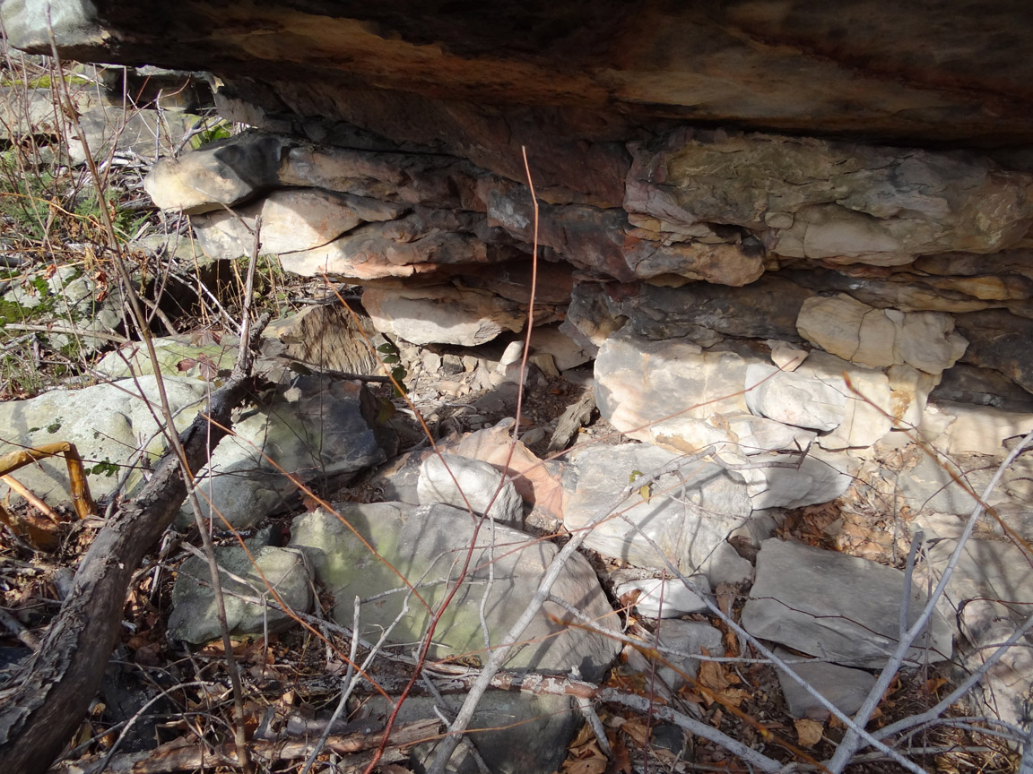
 As you can see - it's a mess in there from falling debris - but looks like a couple possible stone tools scattered around.
 The shelter is large enough for a couple of people.
 Hard to tell from this shot - but somebody was poking around in this covered up hole.
 There is also this stone on the floor - could be natural or maybe not - I completely forgot to show this to Butch - if not natural - it looks like it could have been used as a sharpener.
 I know it's hard to tell from this picture - but there is a couple of more possible shelters in all this mess - but that is for another day.
 There is a hell of a view - from all sides. That knoll way off in the distance fascinates me. I will be showing more pictures of it coming up.
 The mountain I call home - is way off in the distance.
 Along the left side is this passage way to the top and the other side of the structure.
 Bill and Butch at the top (roof) looking at the two grinding holes.
 The two grinding stones with that knoll again in the distance.


We always try not to have to touch anything - but they did clean out the holes - before replacing the debris that had built up.

Bill took this closeup of one of the grinding holes - it's easy to get up there. As you can see - it's a bowl within a bowl.

Butch at the grinding hole looking down into what reminds me of a rainspout feature. This looks natural which makes me believe they chose where to put the holes because of this feature. Bill has theory that the holes may have been used to collect water.

Butch thinks the holes were strickly for grinding. Everything all around the site is completely destroyed. So it's hard to tell if there would have been any springs around. CLICK HERE to see a very large grinding stone just down the road from this site.

You can see what clearly looks like another possible shelter.

Stones like these - (that first one looks like a turtle to me) shoved in all over the place. And speaking of turtles - coming up - more on a turtle shaped cairn.

Simple but beautiful.

Heading back down after only exploring the front section.

I took the time to take a couple more shots of the knoll. Bill first sent me a picture of this couple of weeks ago - and I told him at the time - I think there is a mound on top. It looks exactly like the Mound in Westmont - CLICK HERE.

------------------------

Just thru the tree's - you can barely make out the traces of a mound.

But now back to more important things. Bill mentioned two stone walls on the outskirts - that will soon be completely destroyed due to mine activity.

Nice simple rockpile spotted along the way.

Also saw this cairn that looks slightly disturbed - but note where the arrow is - I didn't notice this headlike feature on site - but sort of reminds me of a snapping turtle.

Checking it out from the front though - it's the possible manitou like stone and triangle rock that got my attention. But heading to the other side...

Now this really looks like two turtles sticking out their heads. Guess I should have walked around to the back of it.

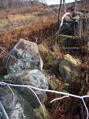
Hitting the first stone wall - the rock shelter we just left would be above this clearing to the right. Bill said this chunk of land was a farm from the 1830's to the 1930's.

After a stop here - heading to the second wall.

Bill leading the way - walking this whole section - I spotted even more rockpiles on my left hand side all along the way to this clearing - which will be explored another day.

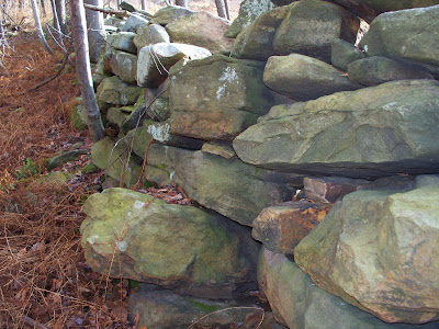
The second wall - functional and not fancy - but still a work of art.

-------------------------------

--------------------

----------------------------------

-----------------------------------------

---------------------------------------

--------------------------------------------

---------------------------------------

------------------------------------------

--------------------------------------------------

-----------------------------------------

Time to head back around to the car.

The rock shelter is actually located behind this open pit mine.

----------------------------------------

Three species of visitors - us, deer and coyote.

And finally I leave you with this lonely cairn - spotted on the way out.
Lovely pictures! So sad that they are mining this area. Is it for coal?
ReplyDeleteVery interesting
ReplyDelete