This is an image of the area we have been studying from 1930 courtesy of http://www.pennpilot.psu.edu/. Thought I'd take the time to recap some of the discoveries we have been making into one complete post. I've circled the mound at Evans Hill - the arrow is pointing to one group of rockpiles (there are many more rockpiles there) and the area circled inside APX is where THIS ROCK SHELTER is located along with more rockpiles and two sets of walls.
This is a shot from the rock shelter - the shelter also has a unique feature - two grinding holes on the roof.
And this is the Evans Hill mound as seen from what's left of the rock shelter. To recap some of what Reader Bill Carney and myself have been discovering - first off in the area near the rock shelter:
Rockpiles of this type - low to the ground - but slightly built up
Cairns - in this example - turtlelike - there are many more structures in the area - that I could see - but we just didn't have the time to investigate.
And two sets of walls - this is the first shorter with bigger stone. Now there used to be a farm there - the walls most likely probably date from then. At least I think this one does...
But this one which is longer - looks to me to be a bit on the older side and it's built to withstand the wind - I have a feeling this wall might pre-date the farm. For more on this area CLICK HERE. Now on to the area getting closer to the mound.
Cairns such as this example - the whole area within at least a quarter mile is loaded with possible structures.
Along with this beautiful grinding stone - when we stopped at the home of the owner of this land - his yard had more possible cairns - but I felt kind of funny about taking pictures there. So at this point - we have a rock shelter, many rockpiles and cairns and two sets of walls - that we have found so far. Now onto the mound in question.
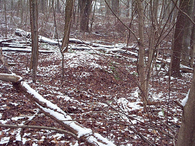
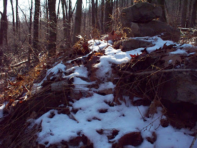
You can see two piles in this shot and what looks like a possible manitou stone. To help give you an understanding of the area - so far we have found structures to the left, middle and righthand sides of this photo along with assorted arrowheads. The pile in the foreground looks promising - CLICK HERE for the video Bill shot....but unfortunately....
When the snow melted this rockpile as you can see has been reworked into a shooting target - so it's impossible to tell how this possible manitou might have been placed or used within this rockpile.
The following three images of the site is courtesy of Kathy K - she runs twoheadwaters.blogspot.com and these Google Earth images were written up on a post about the site CLICK HERE at rockpiles.blogspot.com.
----------------
In regards to this Google Earth shot Kathy says "I don't think Google Earth accounts for the tree line. I also think the accuracy of Google Earth is distorted because the image comes out as if you are floating about 10 feet off the ground (this is a rough guess based on USGS topo compared to the Google Earth image altitude). First hand accounts are, of course, much better than simulations, but I find it's great for looking at sites in a general sense. It also keeps me looking at the horizon whenever I'm at a site, even if it's not clearly visible from a structure, I try to move around until I can see the horizon and take a picture."
Now this is an actual shot of the sunset
I'd asked Bill - if he had a chance to head out to the site last week for the Winter Solstice - to see if maybe on the off chance the area might be set up as a "calender" marking the change of seasons. This is what the setting sun looked like on 12-24. Interesting - but this theory of mine could very well be why this site is set up the way it is - but does need alot more investigation to prove and how the rockpiles might lineup and track the skies. CLICK HERE for more video Bill shot of this section. Here are some stills of a couple of more circlelike rockpiles found there:
Circle 1 - the mound is just beyond those trees
Circle 2
Circle 3
Circle 4
And circle 5 - but hold on to your hat - it gets even better - we also have the following even closer to the mound:
More rockpiles
--------------------
----------------------
----------------------
-------------------------
this one looks like it might have a possible hollow
and if these rockpiles aren't enough....I also have the following for you:
A bunch of these smaller type rockpiles and for dessert
this nice little split-wedge example to nibble on.
This site holds such great promise - and it's going to be a project to mark the exact GPS of all the structures involved - and that's going to take some time - but that's the way it is - and we have searched only some sections quickly - there is a vast area yet to be explored - and we are on a deadline for certain areas because the strip mine located there is expanding - there is also a Marcellus Gas Well in an area a couple of miles behind the mound. But when it comes to taking shots of the mound itself - so far we have been unable to convince the landowner to let us on the actual mound. In fact we got booted off - none too nicely when we asked - and we were very polite about it.
This site is driving me crazy because I am thinking about it all the time - because with hunting season and my shift and the occassional snow - it just hasn't been in cards for me to spend quality time there.


